Anna Bright Calls the Ha Giang Loop “a Dream”: Inside Her Northern Vietnam Adventure
Last updated: September 17, 2026
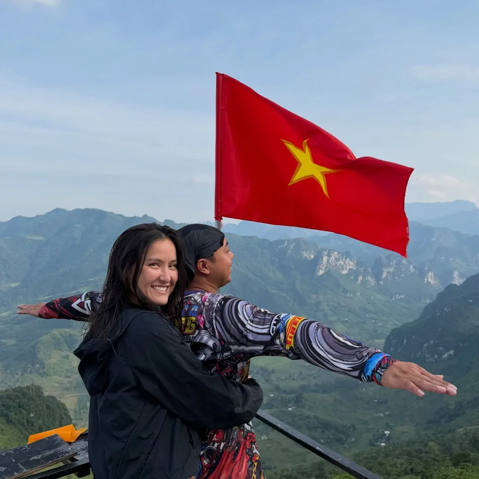
From winding mountain roads and waterfall swims to homestay dinners and shots of local corn liquor, American pickleball star Anna Bright’s journey through the Ha Giang Loop offered more than spectacular scenery. Her experience reveals why this remote corner of northern Vietnam has become one of the country’s most memorable adventures for international travelers.
After meeting fans in Hanoi, American pickleball player Anna Bright traded the Vietnamese capital’s busy streets for the mountains of the far north.
Her next destination was the Ha Giang Loop, a road journey that has become increasingly familiar among travelers looking for a more adventurous side of Vietnam.
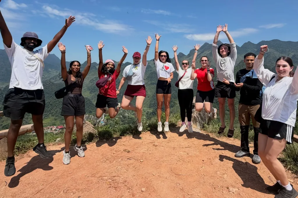
Over two days, Bright traveled by motorbike, went trekking near the Vietnam–China border, met local children, swam at a waterfall, stayed at a homestay and sampled local corn liquor.
Looking back on the experience, she described the Ha Giang Loop as “a dream.”
Yet some of the most revealing moments from her journey had little to do with famous viewpoints. Bright spoke just as enthusiastically about the people she met, her local driver, shared meals and the unexpected experiences that unfolded along the road.
That combination of landscape and human connection helps explain why Ha Giang has become such a distinctive journey for travelers exploring northern Vietnam.
From Hanoi to a Very Different Side of Vietnam
Before heading north, Bright experienced Hanoi in a way familiar to many first-time visitors: wandering through the Old Quarter, eating bun cha and stopping for coffee.
Travel roughly 300 kilometers north of the capital, however, and the surroundings change dramatically.
Dense city streets give way to valleys, limestone mountains, farmland and small settlements scattered across the highlands.
Ha Giang is primarily reached by road from Hanoi, with the journey to Ha Giang City taking around six hours depending on the vehicle and road conditions, according to Vietnam Tourism.
From there begins the journey commonly known as the Ha Giang Loop.
The classic route travels through areas including Quan Ba, Yen Minh, Dong Van and Meo Vac, taking riders across mountain passes and through communities in one of Vietnam’s most dramatic northern landscapes.
Among its best-known sections is Ma Pi Leng Pass, where the road runs high above the Nho Que River and the surrounding gorge.
But as Bright discovered, Ha Giang is about much more than reaching a series of viewpoints.
What Does a Day on the Ha Giang Loop Feel Like?
Bright began one of her days early, with coffee, some time writing in her journal and a small bag packed for the road.
Rather than riding the motorbike herself, she traveled as a passenger with a local driver, Tuấn, who also helped lead the group.
This arrangement is commonly known among travelers as going with an “easy rider.” Instead of navigating unfamiliar mountain roads themselves, travelers ride behind an experienced local driver.
The group spent part of the morning near the Vietnam–China border before continuing on foot.
Along the way, Bright met local children and experienced small glimpses of everyday life in the highlands.
These encounters reveal a side of Ha Giang that can easily disappear behind the destination’s social-media imagery.
The famous photographs tend to focus on mountain passes, cliffs and the turquoise Nho Que River. Yet much of the journey happens between those landmarks: riding through villages, stopping at roadside cafés, sharing meals and watching daily life unfold along the route.
Bright described the scenery as almost difficult to believe.
Her group covered roughly 120 kilometers in one day.
That may not sound like an extraordinary distance, but travel in Ha Giang is rarely about covering kilometers quickly. Mountain roads, frequent stops and constantly changing scenery make the journey itself part of the experience.
Beyond the Mountain Passes
Later in the day came another memorable stop: a waterfall.
Bright joined members of the group in swimming and jumping from the rocks into the water, describing the experience as “crazy.”
By evening, the group arrived at a homestay.
Instead of retreating immediately after a long day on the road, Bright joined everyone for dinner and tried corn liquor, a drink associated with communities in Vietnam’s northern highlands.
She also learned a phrase heard at countless Vietnamese gatherings: “Một, hai, ba… dô!” — roughly the local equivalent of raising a glass together and saying “cheers.”
The night eventually ended with karaoke.
None of these experiences is a major attraction in the conventional sense. Yet together they illustrate why a Ha Giang journey can feel very different from simply visiting a list of sights.
Bright later reflected that the trip had given her new perspectives on Vietnam, its people and everyday life.
She also joked that her local driver took such good care of her that she felt she was being treated “like a princess.”
Why Has the Ha Giang Loop Become So Popular?
For years, Ha Giang remained far less visited by international travelers than destinations such as Hanoi, Ha Long Bay or Hoi An.
That has gradually changed.
Images and videos of motorbikes weaving between limestone peaks have helped introduce the Ha Giang Loop to a much wider international audience.
But describing it simply as a motorbike trip misses much of its appeal.
The journey combines several experiences in one route: a road trip, mountain scenery, hiking opportunities, homestays, local food and encounters with communities across Vietnam’s northern highlands.
Part of the route also crosses the Dong Van Karst Plateau UNESCO Global Geopark, an area recognized for geological landscapes of international significance.
The contrast can be particularly striking for travelers arriving from Hanoi.
One day may begin in a small mountain town. A few hours later, the road climbs above deep valleys and limestone formations. By evening, travelers may find themselves sharing dinner at a homestay with the same people they have spent the day riding alongside.
For many visitors, Ha Giang is therefore remembered less as a single destination than as a journey.
Do You Need to Ride a Motorbike Yourself?
No — and this is one of the most important considerations for anyone planning a Ha Giang trip.
The loop includes steep mountain roads, tight bends and sections where conditions can be challenging. Vietnam Tourism notes that the route requires strong riding skills.
Travelers without substantial motorcycle experience should not feel that riding independently is necessary to experience Ha Giang.
One alternative is an easy-rider tour, similar to Bright’s journey, where an experienced local driver operates the motorbike while the traveler rides as a passenger.
This keeps the open-air experience of traveling by motorbike without requiring visitors to navigate unfamiliar mountain roads themselves.
Private-car itineraries are another option, particularly for travelers who prefer more comfort or do not want to spend several hours each day on a motorbike.
The goal does not have to be “conquering” the Ha Giang Loop on two wheels. The better approach is choosing a style of travel appropriate to your experience, comfort level and itinerary.
How Many Days Should You Spend on the Ha Giang Loop?
Bright’s adventure lasted around two days, giving her a memorable introduction to the region.
Travelers with more time may want to move at a slower pace.
Vietnam Tourism, for example, features a four-day Ha Giang Loop itinerary. A three- or four-day journey can allow more time for stops around Dong Van, Meo Vac and villages along the route, rather than turning each day into a race between overnight destinations.
Travelers should also account for the journey between Hanoi and Ha Giang.
Ha Giang City, the main gateway to the region, lies roughly 300 kilometers from Hanoi, and road travel generally takes several hours.
For that reason, Ha Giang tends to fit more naturally into Vietnam itineraries that dedicate several days to the north rather than trying to squeeze the loop into a short visit.
When Is a Good Time to Visit Ha Giang?
Ha Giang changes noticeably with the seasons.
Vietnam Tourism identifies September through November as a particularly pleasant period, when temperatures are cooler. The region is also popular during buckwheat flower season later in the year.
April through June is generally warm, while July and August can bring hotter weather and regular monsoon rain.
There is no single season that suits every traveler. Mountain weather can change quickly, and road conditions deserve consideration regardless of the month.
A little flexibility can make a significant difference when traveling in this part of Vietnam.
Who Is the Ha Giang Loop For?
The journey is particularly suited to travelers who enjoy road trips, mountain landscapes, photography, light trekking and experiences that bring them closer to local communities.
It may be less suitable for travelers looking primarily for relaxation or those uncomfortable with long periods of road travel.
It also rewards time.
Trying to rush through the mountains simply to photograph the best-known viewpoints can mean missing much of what makes the journey memorable in the first place.
Bright’s experience illustrates this particularly well.
The Ha Giang Beyond the Photographs
Perhaps the most interesting part of Anna Bright’s journey is what she chose to remember.
Not only the mountains.
She talked about her driver. The children she met along the way. Lunch. A waterfall. Corn liquor. Karaoke. And new friends.
After leaving, Bright wrote about how remarkably beautiful the world could be and said she hoped to return to Ha Giang one day.
For travelers planning their own journey through Vietnam, her experience offers a useful perspective on the Ha Giang Loop.
The photographs of Ma Pi Leng Pass and the Nho Que River may be what first convince you to go.
But the moments you remember afterward may be the ones you never planned at all.